


La Chaudiere par la Coulance

cousam
User
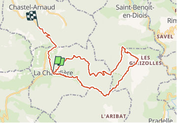

Length
20 km

Max alt
1020 m

Uphill gradient
681 m
Km-Effort
30 km

Min alt
463 m

Downhill gradient
838 m
Boucle
No
Creation date :
2021-02-28 08:18:21.964
Updated on :
2021-04-13 17:07:23.02
7h46
Difficulty : Very difficult

FREE GPS app for hiking
 SityTrail
IGN / Geographical institutes
SityTrail Plus
The world is yours!
About
Trail Walking of 20 km to be discovered at Auvergne-Rhône-Alpes, Drôme, La Chaudière. This trail is proposed by cousam.
Description
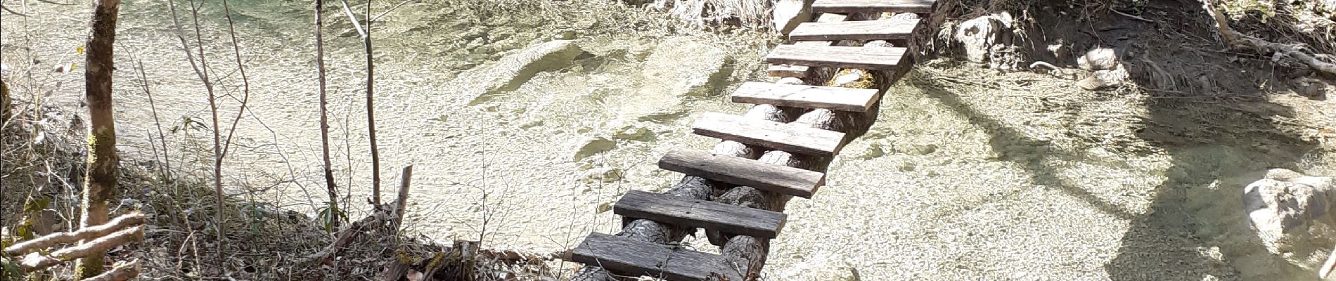
Boucle au départ de la chaudière, en longeant la Coulance
très Hard,surtout en février, car beaucoup d'eau.
Plusieurs rappels, pour contourner Les vasques .
Photos


Positioning
Country:
France
Region :
Auvergne-Rhône-Alpes
Department/Province :
Drôme
Municipality :
La Chaudière
Location:
Unknown
Start:(Dec)
Start:(UTM)
675752 ; 4944504 (31T) N.
Comments